Routes to School Mapping
Purpose:
To help students and their families to identify and use safe walking and cycling routes to school within their neighbourhood.
Description:
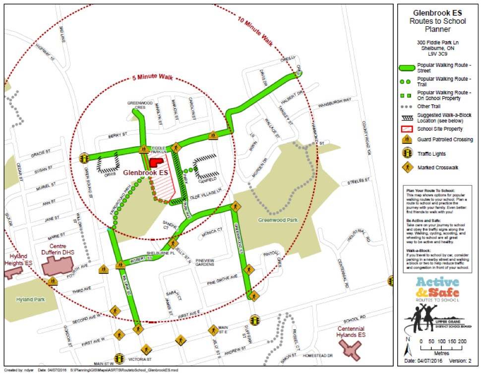
A Routes to School Map shows the network of streets and trails in the neighbourhood surrounding a school, and highlights routes that students can safely walk and cycle. It can also highlight other useful information such as walking times, the location of traffic lights and crossing guards, bike lanes, transit stops and pedestrian crossings. These maps can also be useful for communicating information about other active transportation initiatives, including Walking School Bus routes and stops, Drive to Five locations or Wayfinding.
A good quality Route Map is a valuable resource for a school to help educate students and families about their neighbourhood, engage them in discussion and encourage them to try walking and cycling. The process of creating a map is also a great engagement opportunity by inviting students, families and school staff to contribute their ideas. The finished map can be shared widely through the school website, newsletters, information kits and bulletin boards.
In the classroom, teachers can task students with drawing out routes, identifying areas of interest and concern in the neighbourhood, then coming to a group consensus on the “best routes” for walking or cycling to school. With this approach, the learning that happens through the process of creating the map is as much an outcome as the map itself.
What you will need:
Base map on which to draw routes, map showing extent of your school catchment area.
Help:
Teachers, school board planning staff, municipal transportation planning staff, student transportation services, police services.
Resources:
| Examples of Routes to School Maps are available from Green Communities Canada. |