Wayfinding
Purpose:
To help families identify and follow safe walking and cycling routes to school. Wayfinding signs can also alert drivers to watch out for students along popular routes.
Description:
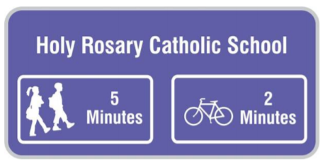
| Installation of street signs along popular routes to school, showing which way to go and the distance/journey time to get to school. Wayfinding signage can be enhanced by adding paint markings on sidewalks to increase visibility and engage young children (e.g. playful words and games).
Wayfinding is only recommended for schools that have a high proportion of students who live within walking distance (up to 3 km from school) to make use of the initiative. Any traffic safety issues on the routes to school need to be addressed before implementing a wayfinding initiative (e.g. lack of sidewalks and/or safe crossings for pedestrians). The main steps to implementing Wayfinding include: Wayfinding can be linked with other encouragement initiatives, including Routes to School Mapping, Walking School Bus and Drive to Five. |
What you will need:
| Support from your municipality and other local partners to fund, plan, install and maintain the signs and paint markings.
Data to inform where the routes should go, including information about: |
Help:
Municipality (Transportation Planning and Public Works staff), public health, student transportation services, police services, local community/neighbourhood associations.
Resources:
| Signs of the Times: School Wayfinding Best Practices webinar presented by Green Communities Canada Toronto Active and Safe Routes to School Pilot project by City of Toronto Signing Routes to School: A Process Evaluation by Waterloo Region Active & Safe Routes to School Committee Examples of Wayfinding projects are available from Green Communities Canada |